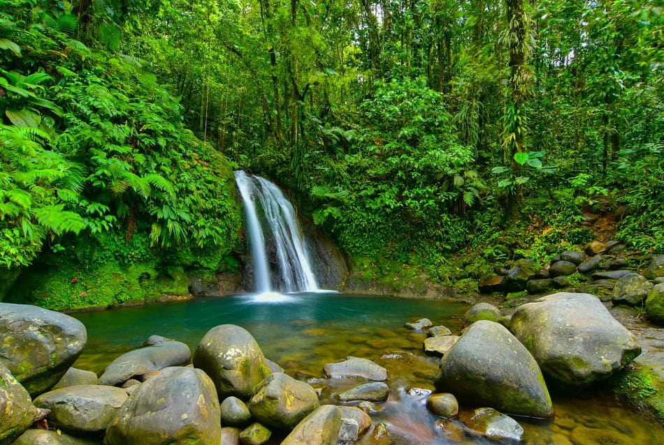
Nicknamedée « Isleof Beautiful Waters » (Karukéra in Carib languageïby the Ameréindians, the first inhabitants of the area, Basse-Terre unéfurls the splendor of its tropêical forest, its hiking trails,é its waterfalls, its volcano (La Soufrièère) and… its diving spots.é Facing à Malendure, the îPigeon islets, which could fit in a squareé of 250 meètersôté, welcome between 15,000 and 20,000 divers per year.
Recognizable, inimitable with its faded red hat, the bust of Commander Cousteau stands at twelve meters deep. 80 kilos of bronze resting in peace since January 16, 2004. For a long time, the place was called « Cousteau Reserve », although no official reserve status was attached to it, the area was then simply under a prefectural order prohibiting hunting and anchoring.
The island legend that claimed the Commander shot part of « The Silent World » there, which won the Palme d’Or at the Cannes Festival in 1956 and an Oscar for Best Documentary in the USA the following year, was debunked when the statue was submerged by Albert Falco himself. « It’s all false, he then asserted. The film was mainly shot in the Red Sea and the Indian Ocean « . Since then, the bust has lost its colors and the area now has an official status. On June 3, 2009, decree No. 2009-614 incorporated it into the Guadeloupe Islands National Park and classified it as « Heart of the Park ».
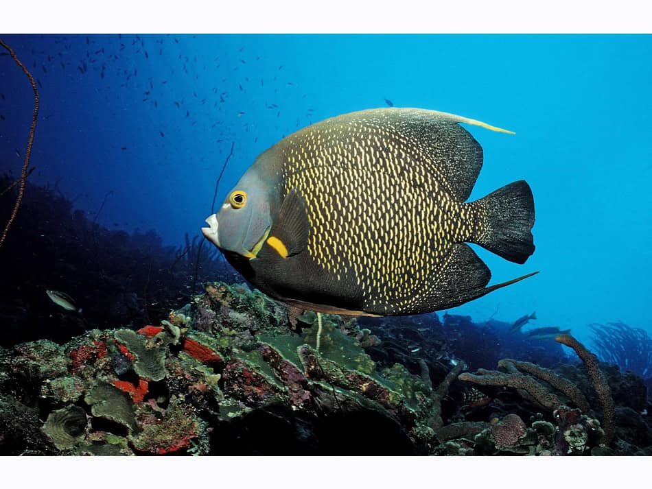
The walls surrounding the two small islands, Grand Ilet and Petit Ilet, harbor relatively different sites, due to their exposure to the sun and light, the current running through them, the slope, the temperature… A variety of parameters that ensure the diversity of species, despite a limited space: 38 species of hard corals, 155 of fish, 26 of gorgonians, 16 of crustaceans, 267 of mollusks, and 58 sponges have been recorded here.
From the Japanese Garden à to Pointe Barracuda
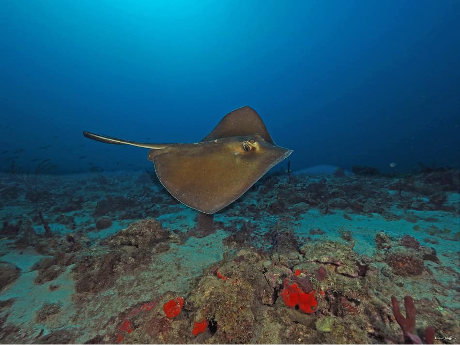
In the minds of divers, the Caribbean seabed doesn’t constitute a prime piece, a destination for which they would go to great lengths and save penny after penny. But at least, in this protected area of Guadeloupe, they know what they will find. Most sites do not exceed 20 meters and go down gently, allowing you to enjoy them without even reaching the maximum depth. And the turtles, both green and hawksbill, are present everywhere.
The Japanese Garden (- 25 m): a rocky pinnacle with a cave, often shelters large crustaceans. Sponges cover the landscape punctuated by gorgonians. The seabed gently slopes away to the open sea, but the most beautiful part is above. Ideal for beginners.
The Anti-cyclone Bowlé(- 40 m): a plateau at -15m on which you can move, then a medium slope. Boxfish, triggerfish, grunts, and trumpetfish slip between various sponges. un plateau à -15m sur lequel vous pouvez évoluer, puis une pente moyenne. Poissons bourses, coffres, pagres et trompettes se faufilent entre des éponges variées.
Pointe aux Carangues a plateau at -15m on which you can move, then a medium slope. Boxfish, triggerfish, grunts, and trumpetfish slip between various sponges. with big-eyed, gray or yellow jacks deploying against a backdrop of barrel sponges (Xestospongia muta) monumental, very often squat by crustaceans proportional in size to their hosts.
Pointe Barracuda (- 50 m): barracudas and solitary spotted drumfish roam here. In the gorgonians, look for the famous shells called Caribbean money-cowries with ocelli (Cyphoma Gibbosum).
The Caye (- 14 m): to be done at night. Cuttlefish in open water, turtles, grunts, and goatfish frequently appear. In the crevices of rocks: octopuses, surgeonfish, fire parrotfish. Snake stars, corallimorphs (« jewel anemones »).
Des éwrecks accessible
The Franjack (- 24 m)
Launched in 1958 from a Swedish shipyard, this 50-meter-long sand dredger was long used for recovering glacial moraines before taking root in La Rochelle in 1974 and embarking on a career in drainage work. Setting sail for the Guadeloupe Islands, it was destroyed by Hurricane Hugo on September 17, 1989.
Scuttled near the coast on June 9, 1996, it sank on its right side on a sandy bottom of twenty-four meters, before being righted during a storm. Accessible to all, it’s a very colorful wreck, in good condition (except for the front cabin). Night diving possible.
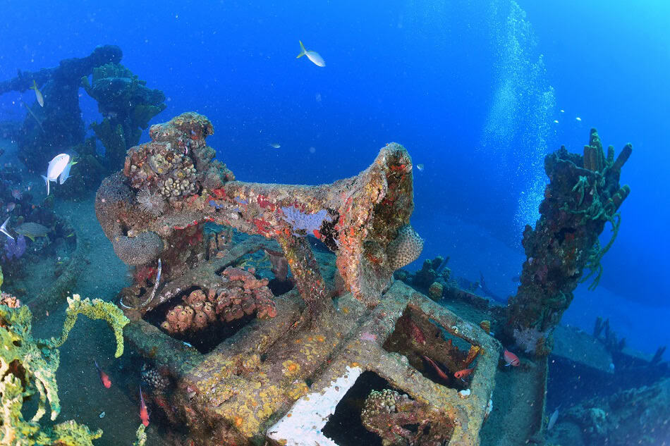
L’Augustin-Fresnel II (- 29 m)
Weighing 660 tons, this 53-meter-long and 9-meter-wide cargo was built in Canada at the very end of the 1940s. It sailed in the Mediterranean before arriving in 1990 in Pointe-à-Pitre where it maintained the Antilles – Guyana zone marking. Retired in 1994, it was sunk in July 2003 near Bouillante. One descends along a line. 15 cabins, outside corridors lined with tube sponges, nooks and crannies… An easy-to-visit wreck and an unexpected haven for many fish.
Le Gustavia (- 40 m)
Named Geocéanique in 1953, this 49-meter-long by 7.5-meter-wide cargo dredger was renamed Gustavia in 1982. Hurricane Hugo caused such damage that its repair was deemed too costly. The Bouillante town hall funded its depollution. Scuttled a few strokes from the coast in 1991, the boat is now colonized by sponges and inhabited by large barracudas. The bridge and wheelhouse are interesting to visit.
A Park, various éeco-systemèsés
With an area of about 135,000 hectares, the maritime space of the Guadeloupe Islands National Park extends from Anse à la Barque, on the leeward coast, to Pointe de la Grande Vigie, north of Grande-Terre. This vast space includes three major ecosystems: wetlands (mangroves, swamp forests, grasslands, and marshes), seagrass beds (‘turtle grass’), and coral reefs.
The head out of theêwater’eau
Distances being long and roads winding, it’s better to dedicate one day to diving and another to exploring rather than splitting the day in two. There are then a thousand things to do:
enjoy a coffee or chocolate at the Chaulet coffee plantation in Vieux-Habitants; take a walk amidst 1000 exotic species at the botanical garden of Deshaies; go whale watching; near Pointe-Noire, visit the Beauséjour coffee plantation, which offers an incomparable view over the Caribbean Sea; set off for the ascent, very early in the morning, of the Soufrière volcano (1467 m); kayak in the Grand Cul-de-Sac Marin, a nature reserve where both terrestrial (1600 ha) and marine (2000 ha) species are protected; observe the island’s only endemic bird, the Guadeloupe woodpecker (Melanerpes herminieri) as well as the little tern (Sterna antillarum), search for the fiddler crab in the mangrove; go hiking to discover the island’s waterfalls, the paths of the former inhabitants; or practice canyoning…
Guadeloupe Islands Tourist Board: www.lesilesdeguadeloupe.com